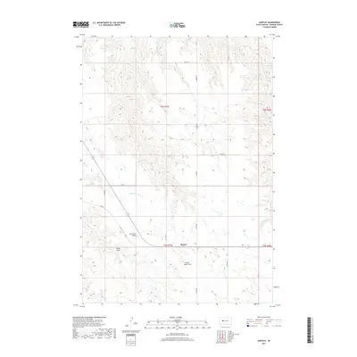
2017 Map of Hartley
USGS Topo · Published 2017About this map
Hartley anchors this portion of Haakon County, located within a landscape defined by the drainage networks of the Cheyenne River watershed. The terrain is characterized by a series of significant erosional features, including Elm Tree Draw, Haxby Draw, and Council Bear Draw, which carve through the high plains. These ephemeral watercourses flow toward larger systems like Indian Springs Cr and the W Fork Spotted Bear Cr. The map's grid-based road system, including 211th Ave and 201st St, illustrates the organized rural development of the region, where transportation routes follow section lines despite the undulating topography. This survey captures the spatial arrangement of a ranching and agricultural community where water management and land relief dictate the placement of local infrastructure.
Find a feature on this map
20 named features on this map. Tap any name to fly to it.
Don’t see what you’re looking for? This feature index may not catch every label — zoom into the map to look around manually.
Map Details
Editions of this 2017 Hartley Map
This is the sole edition of this map. No revisions or reprints were ever made.
Other maps of this area

1954 · Pierre
USGS Topo · 1:250,000

1955 · Bridger
USGS Topo · 1:24,000

1955 · Rattlesnake Lake SW
USGS Topo · 1:24,000

1955 · Bridger SE
USGS Topo · 1:24,000

1955 · Hilland NW
USGS Topo · 1:24,000

1958 · Pierre
USGS Topo · 1:250,000

1983 · Post Ranch
USGS Topo · 1:24,000

1983 · Philip
USGS Topo · 1:100,000

1983 · Hilland
USGS Topo · 1:24,000
1983 · Hartley
USGS Topo · 1:24,000