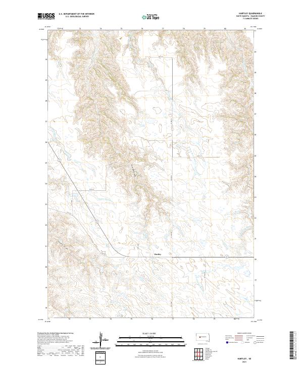
2021 Map of Hartley
USGS Topo · Published 2021About this map
Hartley anchors this 2021 topographic study of the South Dakota plains, situated where the grid of sections meets the drainages of the W Fork Spotted Bear Cr and the E Fork Spotted Bear Cr. The landscape is defined by the subtle, etched erosion patterns of Council Bear Draw and Haxby Draw, which feed toward Indian Springs Cr. A sparse network of section-line roads, including 201st St and 207th St, provides the primary access across the township lines of t6n r19e and t5n r19e. This map illustrates the intersection of modern rural infrastructure and the persistent natural watercourses that have historically dictated the placement of settlements like Hartley in Haakon County.
Find a feature on this map
20 named features on this map. Tap any name to fly to it.
Don’t see what you’re looking for? This feature index may not catch every label — zoom into the map to look around manually.
Map Details
Editions of this 2021 Hartley Map
This is the sole edition of this map. No revisions or reprints were ever made.
Other maps of this area

1954 · Pierre
USGS Topo · 1:250,000

1955 · Bridger
USGS Topo · 1:24,000

1955 · Rattlesnake Lake SW
USGS Topo · 1:24,000

1955 · Bridger SE
USGS Topo · 1:24,000

1955 · Hilland NW
USGS Topo · 1:24,000

1958 · Pierre
USGS Topo · 1:250,000

1983 · Post Ranch
USGS Topo · 1:24,000

1983 · Philip
USGS Topo · 1:100,000

1983 · Hilland
USGS Topo · 1:24,000
1983 · Hartley
USGS Topo · 1:24,000