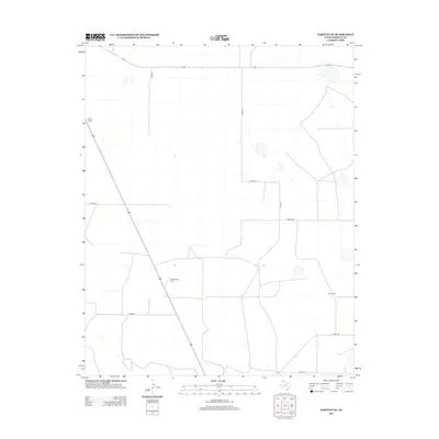
2012 Map of Hartley SE
USGS Topo · Published 2012About this map
The vast cattle country of Hartley County is captured in this 2012 survey, revealing the sparse but established ranching infrastructure that defines the Texas Panhandle. Large-scale landholdings like the Beale Queen Ranch and Edlin Ranch anchor the landscape, connected by a network of rural routes such as Co Road Q and Co Road R. The terrain is characterized by expansive open spaces dotted with numerous small, seasonal water catchments or depressions common to this high plains region.
Find a feature on this map
11 named features on this map. Tap any name to fly to it.
Don’t see what you’re looking for? This feature index may not catch every label — zoom into the map to look around manually.
Map Details
Editions of this 2012 Hartley SE Map
This is the sole edition of this map. No revisions or reprints were ever made.
Other maps of this area

1954 · Tucumcari
USGS Topo · 1:250,000

1958 · Tucumcari
USGS Topo · 1:250,000

1963 · Hartley SE
USGS Topo · 1:24,000

1963 · Hartley NE
USGS Topo · 1:24,000

1963 · Bird Ranch Store
USGS Topo · 1:24,000

1963 · Moran Ranch
USGS Topo · 1:24,000

1971 · Bivins Channing Ranch
USGS Topo · 1:24,000

1971 · Channing NW
USGS Topo · 1:24,000
1971 · Channing
USGS Topo · 1:24,000

1972 · Hartley SW
USGS Topo · 1:24,000