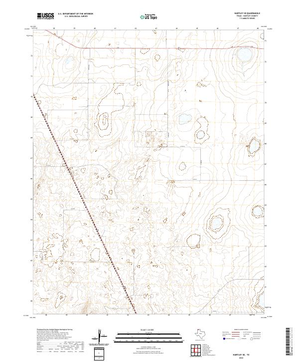
2022 Map of Hartley SE
USGS Topo · Published 2022About this map
The high plains of the Texas Panhandle define the landscape of this contemporary survey, where a grid of rural ranch roads intersects with major transit corridors. Two primary arteries, 87 and 385, converge and cross the terrain, facilitating regional travel through this corner of Hartley County. The drainage patterns and topography are subtly marked by depressions and seasonal catchments that punctuate the wide-open spaces between the established section lines.
Find a feature on this map
11 named features on this map. Tap any name to fly to it.
Don’t see what you’re looking for? This feature index may not catch every label — zoom into the map to look around manually.
Map Details
Editions of this 2022 Hartley SE Map
This is the sole edition of this map. No revisions or reprints were ever made.
Other maps of this area

1954 · Tucumcari
USGS Topo · 1:250,000

1958 · Tucumcari
USGS Topo · 1:250,000

1963 · Hartley SE
USGS Topo · 1:24,000

1963 · Hartley NE
USGS Topo · 1:24,000

1963 · Bird Ranch Store
USGS Topo · 1:24,000

1963 · Moran Ranch
USGS Topo · 1:24,000

1971 · Bivins Channing Ranch
USGS Topo · 1:24,000

1971 · Channing NW
USGS Topo · 1:24,000
1971 · Channing
USGS Topo · 1:24,000

1972 · Hartley SW
USGS Topo · 1:24,000