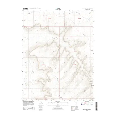
2014 Map of Harts Point North
USGS Topo · Published 2014About this map
Harts Point dominates this section of San Juan County, Utah, where a dramatic plateau surface meets deep, winding erosional drainages. This high desert landscape is characterized by its isolation and limited access, with Hart Point Rd and Needles Overlook Rd providing the primary routes across the benchlands. The complex topography is carved by drainages such as Hatch Ranch Canyon and Bobbys Hole Canyon, which reveal the underlying geologic layers that define this region. Notable landmarks such as Aqueduct Arch and the natural monolith at Eight Mile Rock stand as distinct navigation points in an otherwise repeating pattern of mesas and draws. Water sources are scarce, appearing as seasonal drainages like Threemile Cr and Indian Cr that flow only during peak precipitation. The map provides a clear look at the intersection of early canyon country travel routes, including the W Short Cut and the corridor along Harts Draw.
Find a feature on this map
19 named features on this map. Tap any name to fly to it.
Don’t see what you’re looking for? This feature index may not catch every label — zoom into the map to look around manually.
Map Details
Editions of this 2014 Harts Point North Map
This is the sole edition of this map. No revisions or reprints were ever made.
Other maps of this area

1885 · La Sal
USGS Topo · 1:250,000

1954 · Carlisle 4 SW
USGS Topo · 1:24,000

1954 · Mt Peale 3 NW
USGS Topo · 1:24,000

1954 · Mt Peale 3 SW
USGS Topo · 1:24,000

1954 · Mt Peale 2 SW
USGS Topo · 1:24,000

1954 · Carlisle 4 NW
USGS Topo · 1:24,000
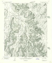
1954 · Carlisle 4 SE
USGS Topo · 1:24,000

1954 · Carlisle 1 SE
USGS Topo · 1:24,000

1954 · Carlisle 4 NE
USGS Topo · 1:24,000

1954 · Carlisle 1 SW
USGS Topo · 1:24,000