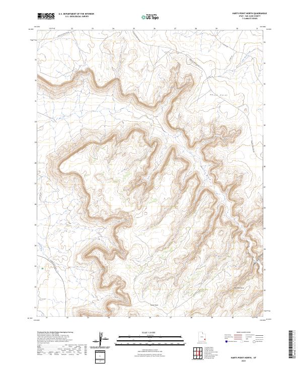
2023 Map of Harts Point North
USGS Topo · Published 2023About this map
Hatch Point and Harts Point define the high mesa country of San Juan County, Utah, in this modern topographic study. The landscape is characterized by intricate drainage patterns and deep erosional cuts, most notably at Harts Draw and the winding Bobbys Hole Canyon. This 2023 survey by the U.S. Geological Survey documents a network of county and federal routes, including Needles Overlook Rd and Lock Hart Rd, which navigate the plateaus above Indian Creek. A notable landmark for hikers and geologists is the Aqueduct Arch, situated in the southeastern section of the quadrangle. The map captures the specialized transportation infrastructure required for this high-desert environment, from well-traveled gravel roads to the remote path of Federal Rte 2444, while tracking seasonal water sources like Little Water Creek.
Find a feature on this map
15 named features on this map. Tap any name to fly to it.
Don’t see what you’re looking for? This feature index may not catch every label — zoom into the map to look around manually.
Map Details
Editions of this 2023 Harts Point North Map
This is the sole edition of this map. No revisions or reprints were ever made.
Other maps of this area

1885 · La Sal
USGS Topo · 1:250,000

1954 · Carlisle 4 SW
USGS Topo · 1:24,000

1954 · Mt Peale 3 NW
USGS Topo · 1:24,000

1954 · Mt Peale 3 SW
USGS Topo · 1:24,000

1954 · Mt Peale 2 SW
USGS Topo · 1:24,000

1954 · Carlisle 4 NW
USGS Topo · 1:24,000
1954 · Carlisle 4 SE
USGS Topo · 1:24,000

1954 · Carlisle 1 SE
USGS Topo · 1:24,000

1954 · Carlisle 4 NE
USGS Topo · 1:24,000

1954 · Carlisle 1 SW
USGS Topo · 1:24,000