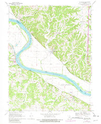
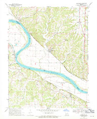
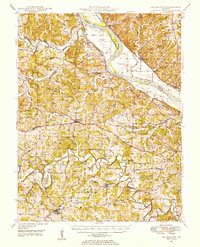
1969 Map of Hartsburg
USGS Topo · Published 1982About this map
The Missouri River forms the central artery of this region, separating the hills of Boone and Cole Counties as it flows past the riverside community of Hartsburg. Along its northern bank, the Missouri Kansas Texas line traces the floodplain, while the Missouri Pacific railroad navigates the southern shore near Marion. This era shows a landscape shaped by both early settlement and institutional development, notably the expansive grounds of the Central Missouri Correction Center situated near Claysville.
Find a feature on this map
39 named features on this map. Tap any name to fly to it.
Don’t see what you’re looking for? This feature index may not catch every label — zoom into the map to look around manually.
Map Details
Editions of this 1969 Hartsburg Map
2 editions found
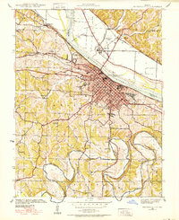
Other maps of this area

1886 · Jefferson City
USGS Topo · 1:125,000

1894 · Jefferson City
USGS Topo · 1:125,000
1939 · Jefferson City
USGS Topo · 1:24,000

1939 · Jefferson City
USGS Topo · 1:62,500

1942 · Jefferson City
USGS Topo · 1:62,500

1944 · Millersburg
USGS Topo · 1:62,500
1946 · Millersburg
USGS Topo · 1:62,500

1947 · Jefferson City
USGS Topo · 1:250,000
1948 · Centertown
USGS Topo · 1:62,500
1948 · Columbia
USGS Topo · 1:62,500