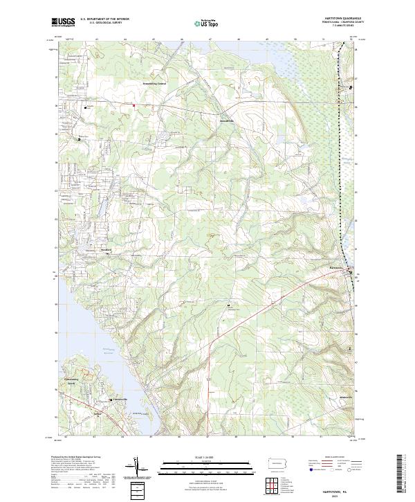
2023 Map of Hartstown
USGS Topo · Published 2023About this map
The Pymatuning Reservoir dominates the landscape of this Crawford County region, where the vast Pymatuning Swamp meets the managed waters near Hartstown. The map reveals a transition from these wetlands to the higher agricultural ground where settlements like Adamsville and Westford are located. A notable historical trace is the Erie Extension Canal visible in the northeast, a reminder of the nineteenth-century transportation network that preceded the current road system.
Find a feature on this map
136 named features on this map. Tap any name to fly to it.
Don’t see what you’re looking for? This feature index may not catch every label — zoom into the map to look around manually.
Map Details
Editions of this 2023 Hartstown Map
This is the sole edition of this map. No revisions or reprints were ever made.
Other maps of this area

1905 · Andover
USGS Topo · 1:48,000

1906 · Linesville
USGS Topo · 1:62,500

1907 · Andover
USGS Topo · 1:62,500

1907 · Kinsman
USGS Topo · 1:62,500

1908 · Shenango
USGS Topo · 1:62,500

1908 · Linesville
USGS Topo · 1:62,500

1950 · Cleveland
USGS Topo · 1:250,000

1956 · Cleveland
USGS Topo · 1:250,000

1958 · Greensville West
USGS Topo · 1:24,000
1958 · Greensville East
USGS Topo · 1:24,000
Featured Places
- Pine Township, PA
- West Fallowfield Township, PA
- Sadsbury Township, PA
- Westford, Pymatuning Central
- Stewartville, PA