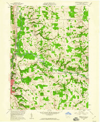
1958 Map of Greensville East
USGS Topo · Published 1960About this map
Greenville serves as the primary hub in this portion of Mercer County, situated at the confluence where the Shenango River and the Little Shenango River meet. The landscape is a complex intersection of early industrial and transit routes, featuring the tracks of the Bessemer and Lake Erie, Pennsylvania R R, and the New York Central. Traces of the historic Erie Canal remain visible near Osgood, marking an older era of Pennsylvania transportation.
Find a feature on this map
48 named features on this map. Tap any name to fly to it.
Don’t see what you’re looking for? This feature index may not catch every label — zoom into the map to look around manually.
Map Details
Editions of this 1958 Greensville East Map
3 editions found
Other maps of this area

1906 · Linesville
USGS Topo · 1:62,500

1908 · Shenango
USGS Topo · 1:62,500

1908 · Linesville
USGS Topo · 1:62,500

1911 · Stoneboro
USGS Topo · 1:62,500

1913 · Stoneboro
USGS Topo · 1:62,500

1923 · Meadville
USGS Topo · 1:62,500

1925 · Meadville
USGS Topo · 1:62,500

1943 · Meadville
USGS Topo · 1:62,500

1943 · Stoneboro
USGS Topo · 1:62,500

1950 · Cleveland
USGS Topo · 1:250,000
Featured Places
- Salem, Sugar Grove Township
- West Fallowfield Township, PA
- East Fallowfield Township, PA
- Sandy Creek Township, PA
- Greenwood Township, PA