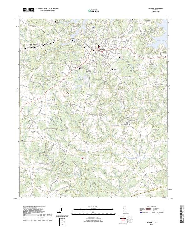
2024 Map of Hartwell
USGS Topo · Published 2024About this map
Hartwell serves as the focal point of this Hart County landscape, situated at a crossroads of Georgia State Routes 77 and 172. The town's residential and commercial grid reaches northward toward the branching fingers of Hartwell Lake, a massive reservoir that has reshaped the local topography. Along the lake's southwestern reaches, Flat Shoals Creek and Gum Branch feed into the primary basin. The surrounding countryside is dotted with small rural communities and historic burial sites, including the Northview Cem and Sanders Grove Cem.
Find a feature on this map
184 named features on this map. Tap any name to fly to it.
Don’t see what you’re looking for? This feature index may not catch every label — zoom into the map to look around manually.
Map Details
Editions of this 2024 Hartwell Map
This is the sole edition of this map. No revisions or reprints were ever made.
Other maps of this area

1891 · Carnesville
USGS Topo · 1:125,000

1893 · Elberton
USGS Topo · 1:125,000

1954 · Greenville
USGS Topo · 1:250,000

1958 · Greenville
USGS Topo · 1:250,000

1958 · Danielsville
USGS Topo · 1:62,500

1958 · Elberton
USGS Topo · 1:62,500

1959 · Hartwell Dam
USGS Topo · 1:24,000

1959 · Lavonia
USGS Topo · 1:24,000

1959 · Hartwell NE
USGS Topo · 1:24,000

1959 · Royston
USGS Topo · 1:24,000