
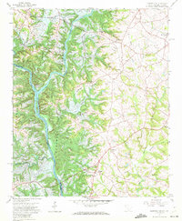
1959 Map of Hartwell NE
USGS Topo · Published 1961About this map
Hartwell Reservoir dominates this landscape along the South Carolina Georgia border, capturing a pivotal moment as the impounded waters of the Savannah River and Seneca River redefined the region's geography. Blue hatching across the map indicates areas subject to controlled inundation, illustrating how the reservoir's rise altered established land patterns. The settlement of Andersonville sits near the confluence, surrounded by a network of rural landmarks such as Holland Store and several country churches including Lyle Memorial Ch and Providence Ch. For those tracing local heritage, the map preserves the original locations of numerous homesteads and community centers like Roberts Ch and New Hope Ch before modern developments further transformed the banks of Sadler Creek and Beaverdam Creek.
Find a feature on this map
30 named features on this map. Tap any name to fly to it.
Don’t see what you’re looking for? This feature index may not catch every label — zoom into the map to look around manually.
Map Details
Editions of this 1959 Hartwell NE Map
4 editions found
Other maps of this area

1888 · Pickens
USGS Topo · 1:125,000

1893 · Elberton
USGS Topo · 1:125,000

1894 · Pickens
USGS Topo · 1:125,000

1950 · La France
USGS Topo · 1:24,000

1951 · La France
USGS Topo · 1:24,000

1954 · Greenville
USGS Topo · 1:250,000

1957 · Anderson
USGS Topo · 1:62,500

1958 · Greenville
USGS Topo · 1:250,000

1958 · Fair Play
USGS Topo · 1:24,000

1959 · Hartwell Dam
USGS Topo · 1:24,000