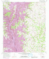
1959 Map of Hartwell NE
USGS Topo · Published 1991About this map
Andersonville sits at the northern reaches of this borderland survey, where the Tugaloo River and Savannah River define the boundary between South Carolina and Georgia. The landscape is dominated by the sprawling waters of Hartwell Lake and Lake Seneca, reflecting a mid-century era of significant hydrological transformation. The map documents the intricate network of drainage that feeds these reservoirs, including Lightwood Log Creek and Generostee Creek.
Find a feature on this map
29 named features on this map. Tap any name to fly to it.
Don’t see what you’re looking for? This feature index may not catch every label — zoom into the map to look around manually.
Map Details
Editions of this 1959 Hartwell NE Map
4 editions found

Other maps of this area

1888 · Pickens
USGS Topo · 1:125,000

1893 · Elberton
USGS Topo · 1:125,000

1894 · Pickens
USGS Topo · 1:125,000

1950 · La France
USGS Topo · 1:24,000

1951 · La France
USGS Topo · 1:24,000

1954 · Greenville
USGS Topo · 1:250,000

1957 · Anderson
USGS Topo · 1:62,500

1958 · Greenville
USGS Topo · 1:250,000

1958 · Fair Play
USGS Topo · 1:24,000

1959 · Hartwell Dam
USGS Topo · 1:24,000