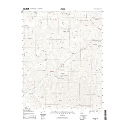
2014 Map of Hartwell
USGS Topo · Published 2014About this map
Huntsville and the surrounding Madison County uplands are defined by a complex network of narrow hollows and prominent peaks. The landscape is carved by numerous waterways including Holman Cr, Brush Cr, and Hock Cr, which dictate the winding paths of the local road system. While Huntsville serves as the primary hub with its Huntsville Municipal Airport, smaller named localities like Hartwell, Roxton, and Drakes Creek illustrate the dispersed rural settlement pattern characteristic of the Ozarks.
Find a feature on this map
62 named features on this map. Tap any name to fly to it.
Don’t see what you’re looking for? This feature index may not catch every label — zoom into the map to look around manually.
Map Details
Editions of this 2014 Hartwell Map
This is the sole edition of this map. No revisions or reprints were ever made.
Other maps of this area

1900 · Eureka Springs
USGS Topo · 1:125,000

1901 · Eureka Springs
USGS Topo · 1:125,000

1943 · St. Paul
USGS Topo · 1:62,500

1945 · Harrison
USGS Topo · 1:250,000

1946 · St. Paul
USGS Topo · 1:62,500

1949 · Harrison
USGS Topo · 1:250,000

1954 · Harrison
USGS Topo · 1:250,000

1956 · Russellville
USGS Topo · 1:250,000
1958 · Goshen
USGS Topo · 1:24,000
1958 · Spring Valley
USGS Topo · 1:24,000