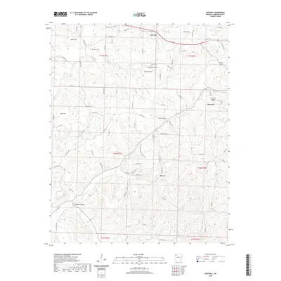
2020 Map of Hartwell
USGS Topo · Published 2020About this map
Huntsville serves as a primary hub in this portion of Madison County, appearing alongside the Huntsville Municipal Airport and several smaller communities including Hartwell, Roxton, and Drakes Creek. The landscape is defined by the sharp relief of the Ozarks, featuring prominent peaks such as Keefer Mtn, Bohannan Mtn, and Boyd Mtn. These highlands are divided by deep drainages like Hartwell Hollow and Mantie Hollow, with water flowing through creeks such as Holman Cr and Pigeon Cr.
Find a feature on this map
50 named features on this map. Tap any name to fly to it.
Don’t see what you’re looking for? This feature index may not catch every label — zoom into the map to look around manually.
Map Details
Editions of this 2020 Hartwell Map
This is the sole edition of this map. No revisions or reprints were ever made.
Other maps of this area

1900 · Eureka Springs
USGS Topo · 1:125,000

1901 · Eureka Springs
USGS Topo · 1:125,000

1943 · St. Paul
USGS Topo · 1:62,500

1945 · Harrison
USGS Topo · 1:250,000

1946 · St. Paul
USGS Topo · 1:62,500

1949 · Harrison
USGS Topo · 1:250,000

1954 · Harrison
USGS Topo · 1:250,000

1956 · Russellville
USGS Topo · 1:250,000
1958 · Goshen
USGS Topo · 1:24,000
1958 · Spring Valley
USGS Topo · 1:24,000