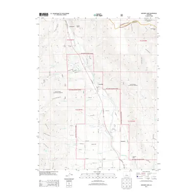
2013 Map of Harvard Lakes
USGS Topo · Published 2013About this map
The Arkansas River corridor in Chaffee County serves as the central artery for this high-altitude landscape, where the valley floor transitions sharply into the steep elevations of the San Isabel National Forest. Settlement patterns are concentrated along the river and US Highway 24 N, with small communities like Riverside and Americus appearing alongside historic educational landmarks including Riverside School and Berrian School. To the west, the terrain rises toward the namesake Harvard Lakes and 3 Elk Reservoir, while the northeastern corner reaches the high point of West Buffalo Peak at the border of Pike National Forest.
Find a feature on this map
64 named features on this map. Tap any name to fly to it.
Don’t see what you’re looking for? This feature index may not catch every label — zoom into the map to look around manually.
Map Details
Editions of this 2013 Harvard Lakes Map
This is the sole edition of this map. No revisions or reprints were ever made.
Other maps of this area

1889 · Leadville
USGS Topo · 1:125,000

1891 · Leadville
USGS Topo · 1:125,000

1935 · Mount Elbert
USGS Topo · 1:62,500

1938 · Mount Elbert
USGS Topo · 1:62,500

1939 · Mount Elbert
USGS Topo · 1:62,500

1942 · Leadville
USGS Topo · 1:125,000

1955 · Buena Vista
USGS Topo · 1:62,500

1955 · Mount Harvard
USGS Topo · 1:62,500

1956 · Montrose
USGS Topo · 1:250,000

1957 · Leadville
USGS Topo · 1:250,000