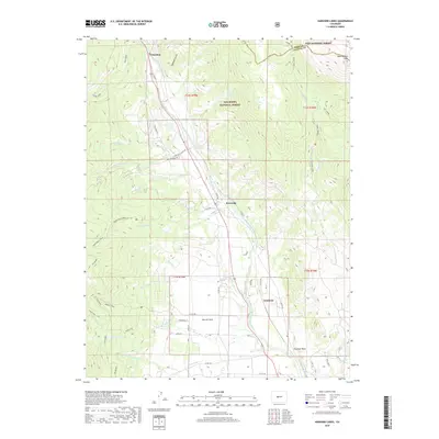
2019 Map of Harvard Lakes
USGS Topo · Published 2019About this map
The Arkansas River corridor serves as the central artery for this portion of the Chaffee County high country, where the water has fostered small settlements like Riverside and Americus. The valley floor is dominated by the Riverside Ditch, an essential piece of irrigation infrastructure that parallels the river to support local agriculture and habitation. To the west, the landscape rises sharply into the San Isabel National Forest, characterized by numerous drainages such as Frenchman Cr and Four Elk Cr. Higher elevations reveal the alpine waters of Harvard Lakes and the 3 Elk Reservoir. On the eastern edge, the boundary between Park and Chaffee counties cuts through the terrain near West Buffalo Peak, while the distinctive granite formation of Elephant Rock stands as a landmark near the southern reaches of the river valley.
Find a feature on this map
56 named features on this map. Tap any name to fly to it.
Don’t see what you’re looking for? This feature index may not catch every label — zoom into the map to look around manually.
Map Details
Editions of this 2019 Harvard Lakes Map
This is the sole edition of this map. No revisions or reprints were ever made.
Other maps of this area

1889 · Leadville
USGS Topo · 1:125,000

1891 · Leadville
USGS Topo · 1:125,000

1935 · Mount Elbert
USGS Topo · 1:62,500

1938 · Mount Elbert
USGS Topo · 1:62,500

1939 · Mount Elbert
USGS Topo · 1:62,500

1942 · Leadville
USGS Topo · 1:125,000

1955 · Buena Vista
USGS Topo · 1:62,500

1955 · Mount Harvard
USGS Topo · 1:62,500

1956 · Montrose
USGS Topo · 1:250,000

1957 · Leadville
USGS Topo · 1:250,000