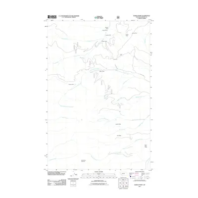
2011 Map of Harvey Point
USGS Topo · Published 2011About this map
Silver King Mountain dominates the southern reaches of this landscape, anchoring a series of drainages and ridgelines in Granite County. The terrain is defined by a dense network of gulches, including Eureka Gulch, Sonora Gulch, and Griffith Gulch, which feed into major watercourses like Harvey Creek and Eightmile Creek. This 2011 survey captures the area's remote character, where human presence is marked primarily by isolated structures such as Harvey Cabin and Griffith Cabin.
Find a feature on this map
29 named features on this map. Tap any name to fly to it.
Don’t see what you’re looking for? This feature index may not catch every label — zoom into the map to look around manually.
Map Details
Editions of this 2011 Harvey Point Map
This is the sole edition of this map. No revisions or reprints were ever made.
Other maps of this area

1903 · Bonner
USGS Topo · 1:125,000

1908 · Philipsburg
USGS Topo · 1:125,000

1909 · Sapphire
USGS Topo · 1:125,000

1919 · Drummond
USGS Topo · 1:125,000

1921 · Drummond
USGS Topo · 1:125,000

1947 · Butte
USGS Topo · 1:250,000

1958 · Butte
USGS Topo · 1:250,000

1959 · Bearmouth
USGS Topo · 1:62,500

1959 · Ravenna
USGS Topo · 1:62,500

1960 · Butte
USGS Topo · 1:250,000