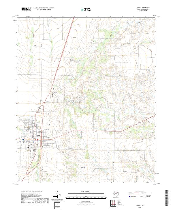
2022 Map of Haskell
USGS Topo · Published 2022About this map
The city of Haskell serves as the focal point of this Haskell County survey, anchored by the Haskell County Courthouse at the heart of the community's grid. The surrounding landscape is defined by a dense network of seasonal watercourses, including Buffalo Cr, Rice Springs Br, and Millers Cr, which carve through the plains. Local infrastructure is represented by the Haskell Municipal Airport to the north and the Willow Cem on the southern edge of town, while Country Club Lake provides a central landmark for recreation. The map's extensive system of county roads, such as Jim Strain Rd and Wheatly Rd, illustrates the organized agricultural partitioning of the Texas Rolling Plains, where every section is accessible by a named route, reflecting a long-standing rural land-use pattern that persists into the 21st century.
Find a feature on this map
56 named features on this map. Tap any name to fly to it.
Don’t see what you’re looking for? This feature index may not catch every label — zoom into the map to look around manually.
Map Details
Editions of this 2022 Haskell Map
This is the sole edition of this map. No revisions or reprints were ever made.
Other maps of this area

1954 · Wichita Falls
USGS Topo · 1:250,000

1958 · Wichita Falls
USGS Topo · 1:250,000

1966 · Haskell
USGS Topo · 1:24,000
1966 · Lake Stamford East
USGS Topo · 1:24,000
1966 · Dudleys Creek
USGS Topo · 1:24,000
1966 · Pinkerton
USGS Topo · 1:24,000
1966 · Lake Stamford West
USGS Topo · 1:24,000
1966 · Irby
USGS Topo · 1:24,000

1967 · Rochester
USGS Topo · 1:24,000

1967 · Weinert
USGS Topo · 1:24,000