
2011 Map of Haskill Mountain
USGS Topo · Published 2011About this map
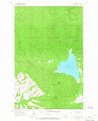
Haskill Mountain serves as the central high point of this 2011 survey, overlooking a landscape defined by forest service development and the drainage basins of the Flathead Valley. The northern reaches are characterized by the winding paths of Ashley Creek and Idaho Creek, which parallel S Ashley Lake Rd as it moves through the terrain. To the west, Lake Rogers is a prominent water feature tucked against the slopes, while the southern portion of the map transitions into the open spaces of Kessler Flats and Browns Meadow.
Find a feature on this map
20 named features on this map. Tap any name to fly to it.
Don’t see what you’re looking for? This feature index may not catch every label — zoom into the map to look around manually.
Map Details
Editions of this 2011 Haskill Mountain Map
This is the sole edition of this map. No revisions or reprints were ever made.
Other maps of this area

1920 · Flathead Lake
USGS Topo · 1:125,000

1943 · Kalispell
USGS Topo · 1:125,000

1956 · Wallace
USGS Topo · 1:250,000

1957 · Kalispell
USGS Topo · 1:250,000

1960 · Kalispell
USGS Topo · 1:250,000

1960 · Wallace
USGS Topo · 1:250,000

1961 · Kalispell
USGS Topo · 1:250,000

1962 · Kila
USGS Topo · 1:24,000

1962 · Blue Grass Ridge
USGS Topo · 1:24,000
1964 · Lake Mary Ronan
USGS Topo · 1:24,000