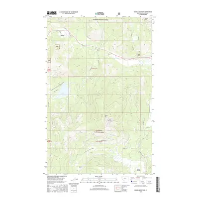
2017 Map of Haskill Mountain
USGS Topo · Published 2017About this map
Marion and Smith Valley serve as the primary human settlements in this western Montana landscape, situated along a corridor defined by Ashley Cr and the historical route of the Idaho Hill Rd. The terrain is dominated by the Salish Mountains, where the peak of Haskill Mtn stands above the timbered slopes of the Flathead National Forest. This 2017 survey shows a complex network of forest development roads, such as Natl Forest Develop Road 915 Rd, which penetrate the high country to reach Kessler Flats and Browns Meadow. The drainage patterns are clearly marked by numerous topographic features like Dower Draw and Jackson Draw, alongside water bodies such as Lake Rogers. These labels reflect a modern era of land management and recreational access within the national forest system.
Find a feature on this map
36 named features on this map. Tap any name to fly to it.
Don’t see what you’re looking for? This feature index may not catch every label — zoom into the map to look around manually.
Map Details
Editions of this 2017 Haskill Mountain Map
This is the sole edition of this map. No revisions or reprints were ever made.
Other maps of this area

1920 · Flathead Lake
USGS Topo · 1:125,000

1943 · Kalispell
USGS Topo · 1:125,000

1956 · Wallace
USGS Topo · 1:250,000

1957 · Kalispell
USGS Topo · 1:250,000

1960 · Kalispell
USGS Topo · 1:250,000

1960 · Wallace
USGS Topo · 1:250,000

1961 · Kalispell
USGS Topo · 1:250,000

1962 · Kila
USGS Topo · 1:24,000

1962 · Blue Grass Ridge
USGS Topo · 1:24,000
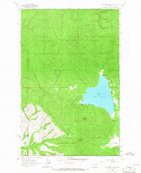
1964 · Lake Mary Ronan
USGS Topo · 1:24,000