2023 Map of Hastings
USGS Topo · Published 2023About this map
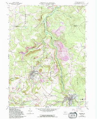
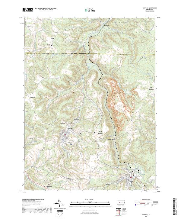
Chest Creek winds through a landscape defined by small coal-country settlements and an extensive network of cemetery grounds in this Cambria County survey. The borough of Hastings serves as a central hub, surrounded by smaller communities such as Saint Benedict, Saint Boniface, and Slickport. The topography is marked by significant industrial carving, particularly visible in the land north of Thomas Mills where the Rock Run ATV Trails Trl now traverses former mining terrain. Genealogists will find a concentrated cluster of burial sites, ranging from the Saints Peter and Paul Byzantine Catholic Cem near Patton to the more isolated East Ridge Cem in the north. The map also captures the clear dividing line between Clearfield and Cambria counties, cutting through Sylvis and crossing Moss Run.
Find a feature on this map
37 named features on this map. Tap any name to fly to it.
Don’t see what you’re looking for? This feature index may not catch every label — zoom into the map to look around manually.
Map Details
Editions of this 2023 Hastings Map
This is the sole edition of this map. No revisions or reprints were ever made.