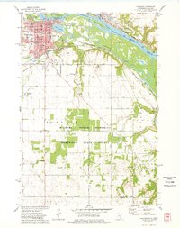
1974 Map of Hastings
USGS Topo · Published 1978About this map
The confluence of the Mississippi River and the Vermillion River anchors this mid-1970s survey of the Minnesota and Wisconsin border. The city of Hastings serves as the focal point, showing a developed street grid supported by institutions like the Jr High Sch, Tilden Sch, and the Courthouse. To the east, across the river, lies Prescott, Wisconsin, situated near Prescott Island. The landscape transitions from urban centers to the structured agriculture and wooded tracts of the Richard J Dorer Memorial Hardwood State Forest.
Find a feature on this map
55 named features on this map. Tap any name to fly to it.
Don’t see what you’re looking for? This feature index may not catch every label — zoom into the map to look around manually.
Map Details
Editions of this 1974 Hastings Map
2 editions found
Other maps of this area

1944 · Red Wing
USGS Topo · 1:62,500

1946 · Hudson
USGS Topo · 1:62,500

1946 · River Falls
USGS Topo · 1:62,500

1949 · River Falls
USGS Topo · 1:62,500

1949 · Hudson
USGS Topo · 1:62,500

1950 · St Paul Park
USGS Topo · 1:24,000

1951 · St Paul Park
USGS Topo · 1:24,000

1951 · Prescott
USGS Topo · 1:24,000

1952 · Red Wing
USGS Topo · 1:62,500

1953 · Saint Paul
USGS Topo · 1:250,000