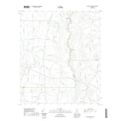
2020 Map of Hastings Fish Pond
USGS Topo · Published 2020About this map
The Alapaha River forms a winding corridor through this section of south Georgia, defining the borders where Berrien, Atkinson, and Lanier counties meet. This landscape is characterized by its numerous "bays"—distinctive Carolina Bay depressions such as Meeting House Bay, Still Bay, and Phoebe Bay—which dot the terrain alongside oxbow formations like Round Lake and Half Moon Lake. The settlement pattern is rooted in rural agriculture and family heritage, evident in the presence of Vickers Farm and several generational burial grounds. Religious and social life centers on sites like the Riverside Missionary Baptist Church and Poplar Springs Ch, which are accompanied by their respective cemeteries. A complex network of local roads, many bearing family names like Waldo Henderson Rd and Hilton Hendley Rd, connects these remote homesteads and points of interest across the marshy lowlands and river bluffs.
Find a feature on this map
93 named features on this map. Tap any name to fly to it.
Don’t see what you’re looking for? This feature index may not catch every label — zoom into the map to look around manually.
Map Details
Editions of this 2020 Hastings Fish Pond Map
This is the sole edition of this map. No revisions or reprints were ever made.
Other maps of this area

1953 · Waycross
USGS Topo · 1:250,000

1958 · Waycross
USGS Topo · 1:250,000

1968 · Lakeland
USGS Topo · 1:24,000

1972 · Tenmile Bay
USGS Topo · 1:24,000

1972 · Kirkland
USGS Topo · 1:24,000

1972 · Willacoochee
USGS Topo · 1:24,000

1972 · Sirmans
USGS Topo · 1:24,000

1972 · Henderson Still
USGS Topo · 1:24,000
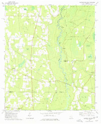
1977 · Hastings Fish Pond
USGS Topo · 1:24,000
1978 · Nashville East
USGS Topo · 1:24,000