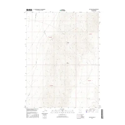
2017 Map of Hastings Pass
USGS Topo · Published 2017About this map
Hastings Pass serves as a critical geographic notch through the high terrain of the Cedar Mountains in Tooele County. This 2017 survey details a landscape defined by traditional Western land divisions, specifically portions of t1s r10w, t1s r9w, t2s r10w, and t2s r9w. The map reveals the persistence of historic routes through the desert, such as Hastings Pass Rd, which follows the natural contours of the pass. Water sources are scarce in this arid environment, making the location of Redlam Spring and Henry Spring vital landmarks for any geographical or historical study of the region. The road network, including Cedar Mt Rd and Aragonite Rd, underscores the transit patterns required to navigate this portion of the Great Basin.
Find a feature on this map
11 named features on this map. Tap any name to fly to it.
Don’t see what you’re looking for? This feature index may not catch every label — zoom into the map to look around manually.
Map Details
Editions of this 2017 Hastings Pass Map
This is the sole edition of this map. No revisions or reprints were ever made.
Other maps of this area

1885 · Tooele Valley
USGS Topo · 1:250,000

1953 · Tooele
USGS Topo · 1:250,000

1955 · Tooele
USGS Topo · 1:250,000

1973 · Ripple Valley
USGS Topo · 1:24,000

1973 · Delle
USGS Topo · 1:24,000

1973 · Hastings Pass NE
USGS Topo · 1:24,000

1973 · Low
USGS Topo · 1:24,000

1973 · Quincy Spring
USGS Topo · 1:24,000

1973 · Hastings Pass
USGS Topo · 1:24,000

1973 · Aragonite SE
USGS Topo · 1:24,000