
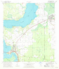
1968 Map of Hastings
USGS Topo · Published 1992About this map
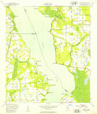
The ST Johns River dominates the western half of this Florida coastal plain survey, acting as a primary axis for settlements and local navigation. Small riverfront communities like Federal Point and Patersonville dot the eastern bank, while East Palatka sits at a critical bend near the Devils Elbow. Inland, the agricultural character of the region is evident in the transition from the wetlands of West Swamp and Cracker Swamp to the organized townsite of Hastings.
Find a feature on this map
57 named features on this map. Tap any name to fly to it.
Don’t see what you’re looking for? This feature index may not catch every label — zoom into the map to look around manually.
Map Details
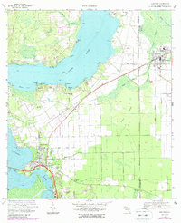
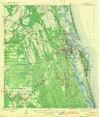
Editions of this 1968 Hastings Map
3 editions found
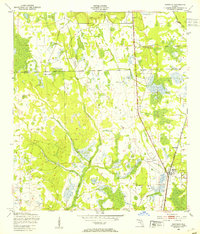
Other maps of this area

1912 · Palatka
USGS Topo · 1:48,000

1915 · Palatka
USGS Topo · 1:62,500

1937 · Elkton
USGS Topo · 1:24,000

1937 · Dinner Island
USGS Topo · 1:48,000
1943 · St. Augustine
USGS Topo · 1:62,500

1943 · Dinner Island
USGS Topo · 1:62,500

1944 · Dinner Island
USGS Topo · 1:62,500

1947 · Bostwick
USGS Topo · 1:50,000
1949 · Bostwick
USGS Topo · 1:24,000
1949 · Riverdale
USGS Topo · 1:24,000