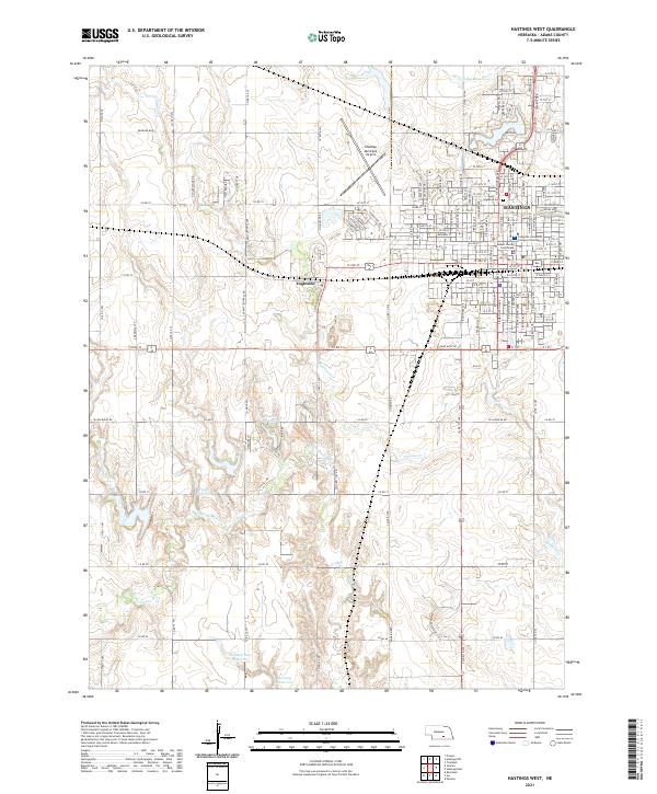
2021 Map of Hastings West
USGS Topo · Published 2021About this map
Hastings serves as the focal point of this west-side survey, revealing the urban expansion and institutional layout of the city in the early 2020s. The map captures critical local landmarks including the Adams County Courthouse and the Creighton University College of Nursing, alongside the residential and commercial street grid that extends toward the Hastings Municipal Airport. Outside the city center, the community of Ingleside sits near the tracks of the BNSF Railway, which remains a dominant industrial corridor through the Nebraska landscape.
Find a feature on this map
156 named features on this map. Tap any name to fly to it.
Don’t see what you’re looking for? This feature index may not catch every label — zoom into the map to look around manually.
Map Details
Editions of this 2021 Hastings West Map
This is the sole edition of this map. No revisions or reprints were ever made.
Other maps of this area

1894 · Kenesaw
USGS Topo · 1:62,500

1896 · Wood River
USGS Topo · 1:125,000

1897 · Red Cloud
USGS Topo · 1:125,000

1898 · Superior
USGS Topo · 1:125,000

1898 · Grand Island
USGS Topo · 1:125,000

1955 · Grand Island
USGS Topo · 1:250,000

1957 · Grand Island
USGS Topo · 1:250,000

1958 · Grand Island
USGS Topo · 1:250,000

1962 · Prosser
USGS Topo · 1:24,000

1969 · Hastings East
USGS Topo · 1:24,000
Featured Places
- Hastings, NE
- Ingleside, NE
- Countryside Parks, Hastings
- Bonnavilla and Eastgate Mobile Home Park, Hastings
- Adams County, NE