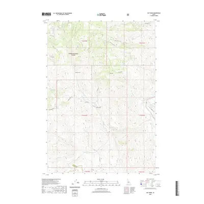
2020 Map of Hat Creek
USGS Topo · Published 2020About this map
Salmon National Forest dominates the high-elevation landscape of Custer County, where complex drainages feed the Salmon River. The terrain is defined by prominent peaks such as Iron Mtn and King Mtn, while deep cuts like Beaver Gulch and South Gulch channel the seasonal flow of high-mountain creeks. The hydrography here is centered on the Big Hat Creek system, including Little Hat Cr and Park Cr, which navigate the steep topography before converging.
Find a feature on this map
31 named features on this map. Tap any name to fly to it.
Don’t see what you’re looking for? This feature index may not catch every label — zoom into the map to look around manually.
Map Details
Editions of this 2020 Hat Creek Map
This is the sole edition of this map. No revisions or reprints were ever made.
Other maps of this area

1955 · Dubois
USGS Topo · 1:250,000

1956 · May
USGS Topo · 1:62,500

1956 · Challis
USGS Topo · 1:62,500

1957 · Challis
USGS Topo · 1:250,000

1958 · Dubois
USGS Topo · 1:250,000

1960 · Challis
USGS Topo · 1:250,000
1962 · Allison Creek
USGS Topo · 1:24,000
1962 · Goldbug Ridge
USGS Topo · 1:24,000
1962 · Degan Mtn
USGS Topo · 1:24,000

1963 · Challis
USGS Topo · 1:250,000