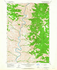
1962 Map of Goldbug Ridge
USGS Topo · Published 1964About this map
The Salmon River carves a deep path through this corner of the Salmon National Forest, defining the landscape with its serpentine bends and steep-walled canyons. During the early 1960s, human activity in this canyon environment was concentrated at the Twin Peaks Ranch, which featured a small Airstrip to facilitate access to this isolated Idaho interior. A network of steep drainages, including Briney Creek, Deer Creek, and Poison Creek, feed into the river from the high country of Goldbug Ridge and Long Ridge. Evidence of mineral exploration appears in the form of Prospects located near Warm Spring Creek, while a Cable Crossing on the river near BM 4240 highlights the practical challenges of navigating this vertical terrain. The map captures a transition point between the river corridor's ranching outposts and the high-elevation wilderness of Poison Peak.
Find a feature on this map
34 named features on this map. Tap any name to fly to it.
Don’t see what you’re looking for? This feature index may not catch every label — zoom into the map to look around manually.
Map Details
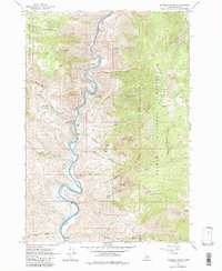
Editions of this 1962 Goldbug Ridge Map
2 editions found
Other maps of this area

1950 · Salmon
USGS Topo · 1:62,500

1950 · Leesburg
USGS Topo · 1:62,500

1951 · Leesburg
USGS Topo · 1:62,500

1951 · Salmon
USGS Topo · 1:62,500

1955 · Dubois
USGS Topo · 1:250,000

1955 · Dillon
USGS Topo · 1:250,000

1956 · Elk City
USGS Topo · 1:250,000

1957 · Dillon
USGS Topo · 1:250,000

1957 · Challis
USGS Topo · 1:250,000

1958 · Dubois
USGS Topo · 1:250,000