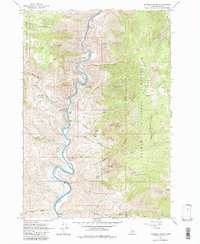
1962 Map of Goldbug Ridge
USGS Topo · Published 1980About this map
The Salmon River carves a deep, sinuous path through this section of the Salmon National Forest in the early 1960s. The landscape is defined by the sharp vertical relief between the river canyon and high points like Twin Peaks and Poison Peak, connected by the prominent Goldbug Ridge. Human activity is concentrated along the narrow river bench, evidenced by the Twin Peaks Ranch and its adjacent Airstrip, providing a vital link in this roadless environment. Smaller tributaries such as Iron Creek, Lime Creek, and Rattlesnake Creek cut into the ridges, while a Cable Crossing near BM 4240 shows the practical engineering used to span the water. A cluster of Prospects near Warm Spring indicates the persistent search for mineral wealth in the mountains long after the initial gold rushes of the region.
Find a feature on this map
34 named features on this map. Tap any name to fly to it.
Don’t see what you’re looking for? This feature index may not catch every label — zoom into the map to look around manually.
Map Details
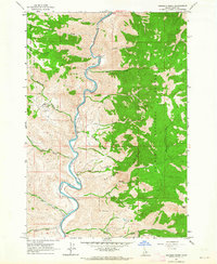
Editions of this 1962 Goldbug Ridge Map
2 editions found
Other maps of this area

1950 · Salmon
USGS Topo · 1:62,500

1950 · Leesburg
USGS Topo · 1:62,500

1951 · Leesburg
USGS Topo · 1:62,500

1951 · Salmon
USGS Topo · 1:62,500

1955 · Dubois
USGS Topo · 1:250,000

1955 · Dillon
USGS Topo · 1:250,000

1956 · Elk City
USGS Topo · 1:250,000

1957 · Dillon
USGS Topo · 1:250,000

1957 · Challis
USGS Topo · 1:250,000

1958 · Dubois
USGS Topo · 1:250,000