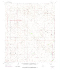
1963 Map of Hat Mesa
USGS Topo · Published 1974About this map
Hat Mesa and the surrounding high plains of Eddy and Lea counties define this landscape of resource extraction and ranching infrastructure during the mid-20th century. The terrain is characterized by broad depressions and ridges, including the extensive San Simon Swale and the prominent Antelope Ridge, which dictate the placement of water sources like Dagger Lake and Bell Lake. These catchment points were vital for the livestock operations at the Brinninstool Ranch and various named tanks such as Lost Tank and the School Section Tanks.
Find a feature on this map
20 named features on this map. Tap any name to fly to it.
Don’t see what you’re looking for? This feature index may not catch every label — zoom into the map to look around manually.
Map Details
Editions of this 1963 Hat Mesa Map
2 editions found
Other maps of this area

1939 · Nash Draw
USGS Topo · 1:62,500

1942 · Clayton Basin
USGS Topo · 1:62,500

1943 · Clayton Basin
USGS Topo · 1:62,500

1943 · Nash Draw
USGS Topo · 1:62,500

1954 · Hobbs
USGS Topo · 1:250,000

1958 · Hobbs
USGS Topo · 1:250,000

1963 · Oil Center
USGS Topo · 1:62,500

1963 · Monument
USGS Topo · 1:62,500

1963 · Laguna Gatuna
USGS Topo · 1:62,500

1963 · Hat Mesa
USGS Topo · 1:62,500