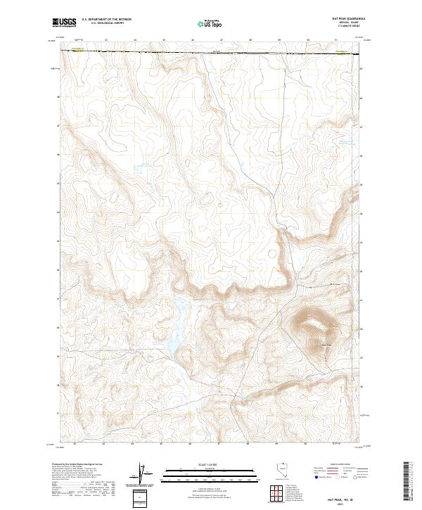
2021 Map of Hat Peak
USGS Topo · Published 2021About this map
Hat Peak rises above the high-desert landscape near the remote intersection of the Nevada-Idaho border and the junction of Owyhee and Elko counties. This topographic survey documents a transition zone where water management is critical for the surrounding ranching and range land. Several seasonal and perennial water sources define the area, including the Garat Reservoir and Reservation Fence Reservoir, alongside natural drainage patterns from Juniper Creek and Duck Creek. A concentration of springs and wetlands is evident near Butte Spring and the lower reaches of Circle Creek, illustrating the hydrological network that sustains this arid high-plateau environment in the modern era. The map provides clear evidence of how topographic features and water access determine the boundaries of local resource use in this isolated borderland.
Find a feature on this map
15 named features on this map. Tap any name to fly to it.
Don’t see what you’re looking for? This feature index may not catch every label — zoom into the map to look around manually.
Map Details
Editions of this 2021 Hat Peak Map
This is the sole edition of this map. No revisions or reprints were ever made.
Other maps of this area

1955 · McDermitt
USGS Topo · 1:250,000

1955 · Jordan Valley
USGS Topo · 1:250,000

1957 · Jordan Valley
USGS Topo · 1:250,000

1958 · Jordan Valley
USGS Topo · 1:250,000

1959 · McDermitt
USGS Topo · 1:250,000

1964 · Hat Peak
USGS Topo · 1:62,500

1971 · Juniper Basin SE
USGS Topo · 1:24,000

1971 · Juniper Basin
USGS Topo · 1:24,000
1973 · Four Corners
USGS Topo · 1:24,000
1974 · Twelvemile Flat SE
USGS Topo · 1:24,000