
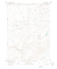
1964 Map of Hat Peak
USGS Topo · Published 1966About this map
The Duck Valley Indian Reservation dominates the eastern portion of this high-desert landscape along the Idaho-Nevada border. This mid-1960s survey illustrates a region defined by complex water management, where numerous small stock ponds and storage basins like Thomas Reservoir, Dick Reservoir, and Groundhog Reservoir support ranching activities in the arid Great Basin terrain. The South Fork Owyhee River carves through the southwestern quadrant, flanked by several quarries and a Gaging Station. Significant landforms such as Hat Peak, Peterson Table, and the distinctive Horseshoe Bend near Poker Flat provide a detailed look at the local topography. This era of land use is further evidenced by the network of jeep trails and pack trails that connect remote outposts like Butte Spring and various unnamed springs across the sagebrush-covered hills.
Find a feature on this map
41 named features on this map. Tap any name to fly to it.
Don’t see what you’re looking for? This feature index may not catch every label — zoom into the map to look around manually.
Map Details
Editions of this 1964 Hat Peak Map
2 editions found
Other maps of this area

1939 · Owyhee
USGS Topo · 1:62,500

1942 · Owyhee
USGS Topo · 1:62,500

1955 · McDermitt
USGS Topo · 1:250,000

1955 · Jordan Valley
USGS Topo · 1:250,000

1956 · Bull Run
USGS Topo · 1:62,500

1957 · Jordan Valley
USGS Topo · 1:250,000

1958 · Jordan Valley
USGS Topo · 1:250,000

1959 · McDermitt
USGS Topo · 1:250,000

1964 · Wilson Reservoir
USGS Topo · 1:62,500

1971 · Juniper Basin SE
USGS Topo · 1:24,000