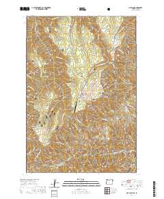
2020 Map of Hat Point
USGS Topo · Published 2020About this map
The Wallowa National Forest and Nez Perce National Forest meet in this landscape of dramatic elevation changes and remote landmarks. The boundary between Oregon and Idaho is defined by the canyon where the Snake Wild and Scenic River flows, overlooked by high points like Hat Point and Granny View Point. The presence of the Memaloose Airport near Memaloose and Grizzly Ridge suggests a region where air travel and specialized trails provide the primary access to the interior highlands.
Find a feature on this map
71 named features on this map. Tap any name to fly to it.
Don’t see what you’re looking for? This feature index may not catch every label — zoom into the map to look around manually.
Map Details
Editions of this 2020 Hat Point Map
This is the sole edition of this map. No revisions or reprints were ever made.
Other maps of this area

1922 · He Devil
USGS Topo · 1:48,000

1954 · Imnaha
USGS Topo · 1:62,500

1954 · Kernan Point
USGS Topo · 1:62,500

1954 · Harl Butte
USGS Topo · 1:62,500

1955 · Grangeville
USGS Topo · 1:250,000

1957 · He Devil
USGS Topo · 1:62,500

1959 · Grangeville
USGS Topo · 1:250,000

1980 · Grangeville
USGS Topo · 1:100,000

1987 · Riggins
USGS Topo · 1:100,000

1990 · Imnaha
USGS Topo · 1:24,000