
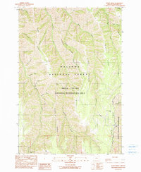
1990 Map of Imnaha
USGS Topo · Published 1990About this map
The Imnaha River carves a deep path through this corner of northeast Oregon, serving as the primary corridor for the small settlement of Imnaha. At the end of the twentieth century, this area remained largely defined by its dramatic elevation changes and the protected boundaries of the Wallowa National Forest. A Gaging Station and a small Cem are situated near the town center, while a Trailer Park provides local infrastructure alongside the river.
Find a feature on this map
45 named features on this map. Tap any name to fly to it.
Don’t see what you’re looking for? This feature index may not catch every label — zoom into the map to look around manually.
Map Details
Editions of this 1990 Imnaha Map
This is the sole edition of this map. No revisions or reprints were ever made.
Other maps of this area

1922 · He Devil
USGS Topo · 1:48,000

1954 · Imnaha
USGS Topo · 1:62,500

1954 · Kernan Point
USGS Topo · 1:62,500

1954 · Harl Butte
USGS Topo · 1:62,500

1955 · Grangeville
USGS Topo · 1:250,000

1957 · He Devil
USGS Topo · 1:62,500

1959 · Grangeville
USGS Topo · 1:250,000

1980 · Grangeville
USGS Topo · 1:100,000

1987 · Riggins
USGS Topo · 1:100,000
1990 · Sleepy Ridge
USGS Topo · 1:24,000