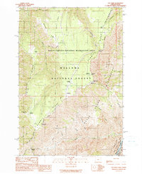
1990 Map of Hat Point
USGS Topo · Published 1990About this map
Hells Canyon dominates this landscape along the Oregon-Idaho State Line, where the descent toward the Snake River defines the topography of the Wallowa National Forest. In this 1990 survey, the high-altitude remote character of the region is evident through the network of forest infrastructure and recreational landmarks. The Memaloose Guard Sta and nearby Memaloose Landing Strip serve as focal points for forest management atop the ridges. Several campsites, including Sacajawea Campground and Hat Point Campground, are positioned near prominent overlooks like Hat Point and Granny View Point. The drainage patterns of Temperance Creek, Sluice Creek, and Indian Grave Creek carve through the massive ridges, while the Western Rim National Recreation Trail provides a continuous path along the canyon's edge, connecting diverse geologic features from Freezeout Saddle to the Sluice Creek Saddle.
Find a feature on this map
37 named features on this map. Tap any name to fly to it.
Don’t see what you’re looking for? This feature index may not catch every label — zoom into the map to look around manually.
Map Details
Editions of this 1990 Hat Point Map
This is the sole edition of this map. No revisions or reprints were ever made.
Other maps of this area

1922 · He Devil
USGS Topo · 1:48,000

1954 · Imnaha
USGS Topo · 1:62,500

1954 · Kernan Point
USGS Topo · 1:62,500

1954 · Harl Butte
USGS Topo · 1:62,500

1955 · Grangeville
USGS Topo · 1:250,000

1957 · He Devil
USGS Topo · 1:62,500

1959 · Grangeville
USGS Topo · 1:250,000

1980 · Grangeville
USGS Topo · 1:100,000

1987 · Riggins
USGS Topo · 1:100,000

1990 · Imnaha
USGS Topo · 1:24,000