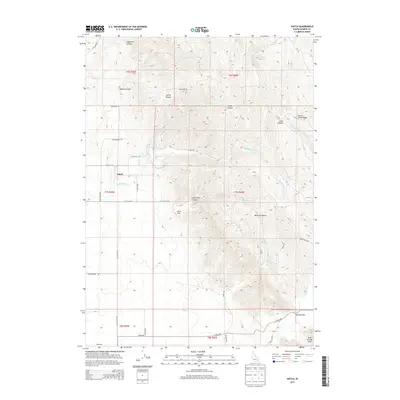
2013 Map of Hatch
USGS Topo · Published 2013About this map
Hatch serves as the primary settlement center in this Caribou County landscape, situated near the western edge where the terrain transitions from the open stretches of Big Flat into the complex drainage networks of the Soda Springs Hills. The map details a significant hydrological system defined by the paths of Eighteenmile Cr and Tenmile Cr, which carve through the high ground. A network of rural routes, including Hatch Loop and Old Hatch Rd, connects the scattered ranchlands and canyons. The eastern portion is dominated by notable topographic features such as Corral Creek Ridge and the steep descents of Moses Canyon and Monroe Canyon. This 2013 survey provides a clear look at the modern land use patterns in southeastern Idaho, where access to high-elevation points like Tenmile Pass remains vital for local transit and livestock management.
Find a feature on this map
36 named features on this map. Tap any name to fly to it.
Don’t see what you’re looking for? This feature index may not catch every label — zoom into the map to look around manually.
Map Details
Editions of this 2013 Hatch Map
This is the sole edition of this map. No revisions or reprints were ever made.
Other maps of this area

1914 · Henry
USGS Topo · 1:48,000

1916 · Henry
USGS Topo · 1:62,500

1917 · Portneuf
USGS Topo · 1:62,500

1948 · Bancroft
USGS Topo · 1:62,500

1948 · Soda Springs
USGS Topo · 1:62,500

1949 · Bancroft
USGS Topo · 1:62,500

1949 · Soda Springs
USGS Topo · 1:62,500

1955 · Preston
USGS Topo · 1:250,000

1958 · Preston
USGS Topo · 1:250,000

1962 · Preston
USGS Topo · 1:250,000