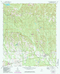
1973 Map of Hatchechubbee
USGS Topo · Published 1985About this map
The Central Of Georgia Railroad railroad anchors the southern landscape of this Russell County quadrangle, passing through the settlements of Wende and Hatchechubbee. This era of documentation reveals a rural Alabama landscape defined by its community institutions and family legacies, evidenced by numerous churches such as Good Hope Ch and Howard Chapel. The topographical detail, based on 1972 aerial photography with mid-1980s revisions, highlights a significant number of cemeteries including the Walker-Williamson Cem and Joshua Cem, providing vital clues for genealogical research in the region.
Find a feature on this map
31 named features on this map. Tap any name to fly to it.
Don’t see what you’re looking for? This feature index may not catch every label — zoom into the map to look around manually.
Map Details
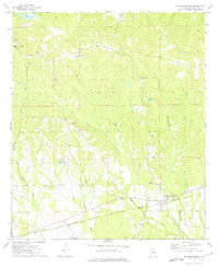
Editions of this 1973 Hatchechubbee Map
2 editions found
Other maps of this area

1914 · Seale
USGS Topo · 1:62,500

1950 · Crawford
USGS Topo · 1:24,000

1950 · Seale
USGS Topo · 1:24,000

1950 · Seale
USGS Topo · 1:62,500

1955 · Seale
USGS Topo · 1:24,000

1955 · Crawford
USGS Topo · 1:24,000

1955 · Seale
USGS Topo · 1:62,500

1955 · Phenix City
USGS Topo · 1:250,000

1957 · Phenix City
USGS Topo · 1:250,000
1957 · Pittsview
USGS Topo · 1:24,000