2022 Map of Hatfield
USGS Topo · Published 2022About this map
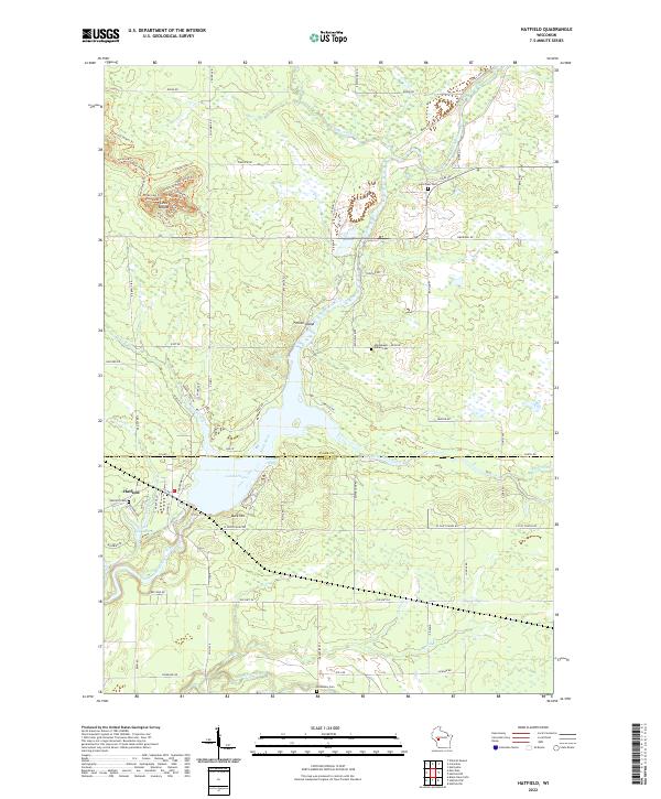
Lake Arbutus dominates the central landscape of this western Wisconsin survey, where the Black River and East Fork Black River converge at the settlement of Hatfield. The map reveals a complex hydrographic network including Klimas Bay, the Upper Backwater, and several distinct tributaries such as Wedges Creek and Mollies Cr. Cultural history is noted through several burial sites, most notably the Winnebago Indian Cem and the Dells Dam Cem near the northern reaches of the river. To the northwest, the prominent topography of Levis Mound is detailed with a dense network of recreational paths including the Yellow Jacket Trl, Hermosa Trl, and Cliffhanger Trl. The boundary between Clark Co and Jackson Co bisects the lake, illustrating the regional significance of this waterway for local administration and recreation.
Find a feature on this map
88 named features on this map. Tap any name to fly to it.
Don’t see what you’re looking for? This feature index may not catch every label — zoom into the map to look around manually.
Map Details
Editions of this 2022 Hatfield Map
This is the sole edition of this map. No revisions or reprints were ever made.
Historical Maps of Jackson County Through Time
3 maps found