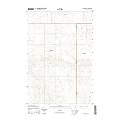
2014 Map of Hathaway NW
USGS Topo · Published 2014About this map
The high plains of Rosebud and Custer Counties are defined by an intricate drainage system feeding the regional watershed. This landscape is dissected by numerous seasonal watercourses, including Coal Creek in the north and the winding Whitetail Creek through the central sections. The terrain follows a high-altitude prairie pattern where traditional settlements are sparse, and land use is primarily dictated by the path of the water and the open range. In the northeastern corner, S Sunday Creek Rd provides the primary infrastructure for the area, following the ridge lines and connecting the disparate drainages of Sage Creek and Steiger Creek. These topographical details offer a clear view of the natural boundaries that shaped early Montana ranching and land claims before modern developments significantly altered the western prairie.
Find a feature on this map
12 named features on this map. Tap any name to fly to it.
Don’t see what you’re looking for? This feature index may not catch every label — zoom into the map to look around manually.
Map Details
Editions of this 2014 Hathaway NW Map
This is the sole edition of this map. No revisions or reprints were ever made.
Other maps of this area

1954 · Forsyth
USGS Topo · 1:250,000

1957 · Forsyth
USGS Topo · 1:250,000

1958 · Forsyth
USGS Topo · 1:250,000

1968 · Sand Buttes
USGS Topo · 1:24,000

1968 · Hathaway
USGS Topo · 1:24,000

1968 · Butterfly Creek
USGS Topo · 1:24,000

1968 · Horton
USGS Topo · 1:24,000

1968 · Hathaway NW
USGS Topo · 1:24,000

1968 · Thurlow
USGS Topo · 1:24,000

1969 · Wild Horse Pass SE
USGS Topo · 1:24,000