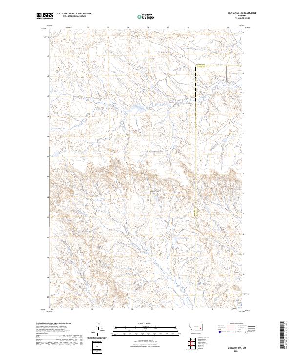
2024 Map of Hathaway NW
USGS Topo · Published 2024About this map
Whitetail Creek and Wilson Creek wind through this remote reach of the Montana prairie, defining the drainage patterns of a landscape shaped by intermittent water and high plains topography. This contemporary survey captures the intricate branching of Coal Creek as it carves through the undulating terrain of the Rosebud and Custer county line. The map reveals the sparse infrastructure of the region, where gravel and unimproved routes like Co Rd 160 and Sunday Creek Rd 5 provide the primary access to vast grazing lands. The intricate contouring illustrates the sharp breaks and coulees common to the area, highlighting the transition between high plateaus and the deep creek beds of Sage Creek and Steiger Creek.
Find a feature on this map
14 named features on this map. Tap any name to fly to it.
Don’t see what you’re looking for? This feature index may not catch every label — zoom into the map to look around manually.
Map Details
Editions of this 2024 Hathaway NW Map
This is the sole edition of this map. No revisions or reprints were ever made.
Other maps of this area

1954 · Forsyth
USGS Topo · 1:250,000

1957 · Forsyth
USGS Topo · 1:250,000

1958 · Forsyth
USGS Topo · 1:250,000

1968 · Sand Buttes
USGS Topo · 1:24,000

1968 · Hathaway
USGS Topo · 1:24,000

1968 · Butterfly Creek
USGS Topo · 1:24,000

1968 · Horton
USGS Topo · 1:24,000

1968 · Hathaway NW
USGS Topo · 1:24,000

1968 · Thurlow
USGS Topo · 1:24,000

1969 · Wild Horse Pass SE
USGS Topo · 1:24,000