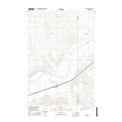
2017 Map of Hathaway
USGS Topo · Published 2017About this map
The Yellowstone River cuts a wide path through this portion of Rosebud and Custer counties, defining the local geography and transportation corridors. Along its northern banks, the small settlement of Sheffield sits near the mouth of Whitetail Cr, while to the south, the community of Hathaway serves as a central point for the surrounding ranching country. The map reveals a landscape deeply connected to its pioneers and rugged environment, evidenced by evocative place names like Graveyard Cr and the nearby Graveyard Creek Rd.
Find a feature on this map
25 named features on this map. Tap any name to fly to it.
Don’t see what you’re looking for? This feature index may not catch every label — zoom into the map to look around manually.
Map Details
Editions of this 2017 Hathaway Map
This is the sole edition of this map. No revisions or reprints were ever made.
Other maps of this area

1954 · Forsyth
USGS Topo · 1:250,000

1957 · Forsyth
USGS Topo · 1:250,000

1958 · Forsyth
USGS Topo · 1:250,000

1968 · Sand Buttes
USGS Topo · 1:24,000

1968 · Hathaway
USGS Topo · 1:24,000

1968 · Butterfly Creek
USGS Topo · 1:24,000

1968 · Horton
USGS Topo · 1:24,000

1968 · Hathaway NW
USGS Topo · 1:24,000

1968 · Thurlow
USGS Topo · 1:24,000
1969 · Moon Creek School
USGS Topo · 1:24,000