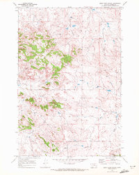
1969 Map of Moon Creek School
USGS Topo · Published 1972About this map
Moon Creek Sch serves as the central cultural landmark in this rural Custer County landscape during the late 1960s. The area is defined by a dendritic network of intermittent watercourses that have carved the terrain, most notably Moon Creek and the curiously named Graveyard Creek. This drainage pattern influenced the placement of early infrastructure, such as the Graveyard Creek Road which follows the natural contours of the valley floor.
Find a feature on this map
13 named features on this map. Tap any name to fly to it.
Don’t see what you’re looking for? This feature index may not catch every label — zoom into the map to look around manually.
Map Details
Editions of this 1969 Moon Creek School Map
This is the sole edition of this map. No revisions or reprints were ever made.
Other maps of this area

1953 · Miles City
USGS Topo · 1:250,000

1954 · Forsyth
USGS Topo · 1:250,000

1957 · Miles City
USGS Topo · 1:250,000

1957 · Forsyth
USGS Topo · 1:250,000

1958 · Miles City
USGS Topo · 1:250,000

1958 · Forsyth
USGS Topo · 1:250,000

1968 · Hathaway
USGS Topo · 1:24,000

1968 · Lignite Creek
USGS Topo · 1:24,000

1968 · Horton
USGS Topo · 1:24,000
1969 · Jack Creek NW
USGS Topo · 1:24,000