
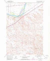
1968 Map of Lignite Creek
USGS Topo · Published 1972About this map
The Old Fort Keogh Military Reservation Boundary anchors the western edge of this landscape, marking a transition from historical military lands to the river-driven economy of Custer County. The Yellowstone River cuts through the northern portion of the sheet, creating a fertile corridor for transportation and industry. The industrial footprint of the era is evident through infrastructure like the Pumping Sta, several Gravel Pit locations, and a Sewage Disposal site, reflecting a period of active land use and utility development.
Find a feature on this map
17 named features on this map. Tap any name to fly to it.
Don’t see what you’re looking for? This feature index may not catch every label — zoom into the map to look around manually.
Map Details
Editions of this 1968 Lignite Creek Map
2 editions found
Other maps of this area

1953 · Miles City
USGS Topo · 1:250,000

1954 · Forsyth
USGS Topo · 1:250,000

1957 · Miles City
USGS Topo · 1:250,000

1957 · Forsyth
USGS Topo · 1:250,000

1958 · Miles City
USGS Topo · 1:250,000

1958 · Forsyth
USGS Topo · 1:250,000

1968 · Big Hill
USGS Topo · 1:24,000

1968 · Miles City
USGS Topo · 1:24,000

1968 · Butterfly Creek
USGS Topo · 1:24,000

1968 · Paddy Fay Creek
USGS Topo · 1:24,000