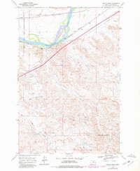
1968 Map of Lignite Creek
USGS Topo · Published 1980About this map
The Old Fort Keogh Military Reservation Boundary anchors the western edge of this 1968 landscape, marking the historic transition from military territory to the commercial corridors of the eastern Montana plains. The Yellowstone River cuts a wide, island-studded path across the northern sector, serving as the primary geographic driver for the area's development. This stretch of river valley is defined by its heavy infrastructure, where the Chicago Milwaukee St Paul and Pacific and Burlington Northern railroads parallel the water, supporting small sidings like Paragon and Ulmer.
Find a feature on this map
16 named features on this map. Tap any name to fly to it.
Don’t see what you’re looking for? This feature index may not catch every label — zoom into the map to look around manually.
Map Details
Editions of this 1968 Lignite Creek Map
2 editions found
Other maps of this area

1953 · Miles City
USGS Topo · 1:250,000

1954 · Forsyth
USGS Topo · 1:250,000

1957 · Miles City
USGS Topo · 1:250,000

1957 · Forsyth
USGS Topo · 1:250,000

1958 · Miles City
USGS Topo · 1:250,000

1958 · Forsyth
USGS Topo · 1:250,000

1968 · Big Hill
USGS Topo · 1:24,000

1968 · Miles City
USGS Topo · 1:24,000

1968 · Lignite Creek
USGS Topo · 1:24,000

1968 · Butterfly Creek
USGS Topo · 1:24,000