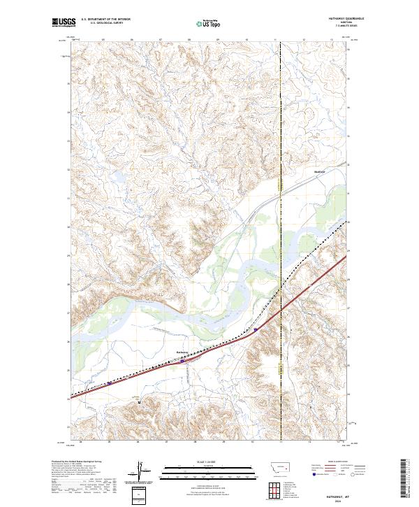
2024 Map of Hathaway
USGS Topo · Published 2024About this map
The Yellowstone River carves a wide valley through the ranching country of eastern Montana, defining the landscape between the small settlements of Hathaway and Sheffield. This modern USGS study reveals a terrain marked by deep coulees and seasonal drainages, where named features like Graveyard Creek and Iron Jaw Creek reflect the local heritage of the Rosebud and Custer County line. Transport and local history are etched into the map via Frontage Rd and evocatively named routes such as Calamity Jane Ln and Tombstone Rd. For genealogists and local historians, the Hathaway Cem serves as a vital anchor near the south bank of the river, situated among a network of rural lanes like Bennett Ln and Hathaway Ranch Ln. The map documents a sparsely populated but distinctly named corridor where the river continues to be the primary geographical influence.
Find a feature on this map
27 named features on this map. Tap any name to fly to it.
Don’t see what you’re looking for? This feature index may not catch every label — zoom into the map to look around manually.
Map Details
Editions of this 2024 Hathaway Map
This is the sole edition of this map. No revisions or reprints were ever made.
Other maps of this area

1954 · Forsyth
USGS Topo · 1:250,000

1957 · Forsyth
USGS Topo · 1:250,000

1958 · Forsyth
USGS Topo · 1:250,000

1968 · Sand Buttes
USGS Topo · 1:24,000

1968 · Hathaway
USGS Topo · 1:24,000

1968 · Butterfly Creek
USGS Topo · 1:24,000

1968 · Horton
USGS Topo · 1:24,000

1968 · Hathaway NW
USGS Topo · 1:24,000

1968 · Thurlow
USGS Topo · 1:24,000
1969 · Moon Creek School
USGS Topo · 1:24,000