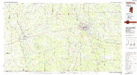
1984 Map of Hattiesburg
USGS Topo · Published 1984About this map
Camp Shelby and the sprawling reaches of the De Soto National Forest dominate the southeastern landscape of this mid-1980s Mississippi survey. Centered on the growing city of Hattiesburg, the map details a region where the piney woods meet the expansive Pearl River valley near Columbia. The land is punctuated by rural landmarks such as Holly Springs Ch and Society Hill Ch, alongside specialized institutions like the Columbia Training School.
Find a feature on this map
231 named features on this map. Tap any name to fly to it.
Don’t see what you’re looking for? This feature index may not catch every label — zoom into the map to look around manually.
Map Details
Editions of this 1984 Hattiesburg Map
This is the sole edition of this map. No revisions or reprints were ever made.
Other maps of this area

1942 · Thomas
USGS Topo · 1:31,680

1947 · Beaumont
USGS Topo · 1:62,500

1947 · Wiggins
USGS Topo · 1:62,500

1947 · New Augusta
USGS Topo · 1:62,500

1947 · Benndale
USGS Topo · 1:62,500

1949 · Wiggins
USGS Topo · 1:62,500

1949 · Beaumont
USGS Topo · 1:62,500

1949 · New Augusta
USGS Topo · 1:62,500

1949 · Benndale
USGS Topo · 1:62,500

1949 · Angie
USGS Topo · 1:31,680