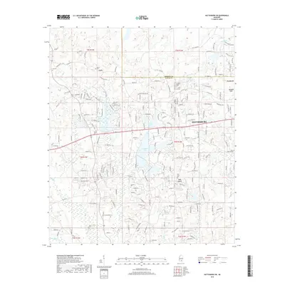
2018 Map of Hattiesburg SW
USGS Topo · Published 2018About this map
Hattiesburg expands westward into the rolling timberlands and watershed divides of the Forrest Co and Lamar Co border. This modern landscape is defined by the growth of suburban residential patterns around Oak Grove and smaller settlements like Clyde. Genealogists will find a high density of burial sites across this quadrangle, including the Old Eaton Cem, Oral Cem, and Rawls Cem, which provide anchors for tracing local family lineages. The terrain is marked by significant water features such as Hennington Lake and Cole Lake, while the high ground of Tallulah Ridge overlooks the various drainages of Big Creek and Perkins Creek. The intricate road network, featuring names like Old Hwy 42 and Marais Ridge, illustrates the 21st-century transition from rural farmland to a more developed residential corridor west of the city center.
Find a feature on this map
190 named features on this map. Tap any name to fly to it.
Don’t see what you’re looking for? This feature index may not catch every label — zoom into the map to look around manually.
Map Details
Editions of this 2018 Hattiesburg SW Map
This is the sole edition of this map. No revisions or reprints were ever made.
Other maps of this area

1953 · Hattiesburg
USGS Topo · 1:250,000

1958 · Hattiesburg
USGS Topo · 1:250,000

1964 · Purvis
USGS Topo · 1:24,000

1964 · Hattiesburg
USGS Topo · 1:24,000

1965 · Hattiesburg SW
USGS Topo · 1:24,000

1965 · Dixie
USGS Topo · 1:24,000

1965 · Eastabuchie
USGS Topo · 1:24,000

1965 · Sanford
USGS Topo · 1:24,000

1969 · Baxterville NE
USGS Topo · 1:24,000

1974 · Sumrall
USGS Topo · 1:24,000