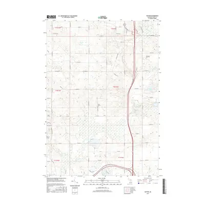
2017 Map of Hatton
USGS Topo · Published 2017About this map
Hatton stands as a focal point in this central Michigan landscape, defined by a network of glacial lakes and wetlands. The terrain is notably dominated by the expansive Bear Swamp and the meandering path of the Middle Br Tobacco River, which flows through the eastern half of the township. Local history is anchored by the Hatton Township Cem and the Harrison RR Grade, reflecting the area's transition from 19th-century resource extraction and rail transport to a modern mix of residential and educational use. The presence of Mid Michigan Community Coll on the northeastern edge highlights the contemporary development of the region, while numerous water bodies like Pfannes Lake, Loon Lake, and Beebe Lake continue to shape the geography of the Hatton area.
Find a feature on this map
70 named features on this map. Tap any name to fly to it.
Don’t see what you’re looking for? This feature index may not catch every label — zoom into the map to look around manually.
Map Details
Editions of this 2017 Hatton Map
This is the sole edition of this map. No revisions or reprints were ever made.
Other maps of this area

1954 · Traverse City
USGS Topo · 1:250,000

1954 · Midland
USGS Topo · 1:250,000

1957 · Harrison
USGS Topo · 1:62,500

1958 · Traverse City
USGS Topo · 1:250,000

1958 · Midland
USGS Topo · 1:250,000

1959 · Midland
USGS Topo · 1:250,000

1959 · Clare
USGS Topo · 1:62,500

1966 · Midland
USGS Topo · 1:250,000

1969 · Meredith SW
USGS Topo · 1:24,000
1969 · Browns Corners
USGS Topo · 1:24,000