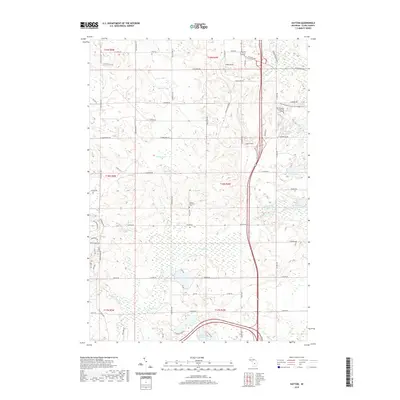
2019 Map of Hatton
USGS Topo · Published 2019About this map
Hatton Township Cem serves as a central landmark in this portion of Clare County, situated just west of the major transportation corridor through the region. The landscape is defined by an intricate network of wetlands and water bodies, including the expansive Bear Swamp and the headwaters of the Middle Br Tobacco River. To the north, Mid-Michigan Community College marks a point of modern civic development, while the Harrison RR Grade provides a physical connection to the area's industrial past. This part of Michigan is characterized by numerous small lakes such as Pfannes Lake, Handy Lake, and Lake Enola, many of which are connected by minor watercourses like Spike Horn Cr and Loon Lake Cr. The road grid, including N Old State Ave and N Harrison Ave, anchors the rural settlement pattern around the community of Hatton.
Find a feature on this map
77 named features on this map. Tap any name to fly to it.
Don’t see what you’re looking for? This feature index may not catch every label — zoom into the map to look around manually.
Map Details
Editions of this 2019 Hatton Map
This is the sole edition of this map. No revisions or reprints were ever made.
Other maps of this area

1954 · Traverse City
USGS Topo · 1:250,000

1954 · Midland
USGS Topo · 1:250,000

1957 · Harrison
USGS Topo · 1:62,500

1958 · Traverse City
USGS Topo · 1:250,000

1958 · Midland
USGS Topo · 1:250,000

1959 · Midland
USGS Topo · 1:250,000

1959 · Clare
USGS Topo · 1:62,500

1966 · Midland
USGS Topo · 1:250,000

1969 · Meredith SW
USGS Topo · 1:24,000
1969 · Browns Corners
USGS Topo · 1:24,000