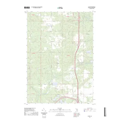
2023 Map of Hatton
USGS Topo · Published 2023About this map
Bear Swamp dominates the central lowlands of this Clare County landscape, surrounded by a complex network of glacial kettle lakes and streams. The Middle Branch Tobacco River and Five Lakes Creek drain the southern sections, while numerous named bodies of water like Pfannes Lake, Handy Lake, and Loon Lake define the northern and western reaches. The presence of the Harrison RR Grade cutting through the center of the township provides a clear record of the area's historical transportation corridors, while the Hatton Township Cem serves as a primary point of interest for local genealogy researchers.
Find a feature on this map
45 named features on this map. Tap any name to fly to it.
Don’t see what you’re looking for? This feature index may not catch every label — zoom into the map to look around manually.
Map Details
Editions of this 2023 Hatton Map
This is the sole edition of this map. No revisions or reprints were ever made.
Other maps of this area

1954 · Traverse City
USGS Topo · 1:250,000

1954 · Midland
USGS Topo · 1:250,000

1957 · Harrison
USGS Topo · 1:62,500

1958 · Traverse City
USGS Topo · 1:250,000

1958 · Midland
USGS Topo · 1:250,000

1959 · Midland
USGS Topo · 1:250,000

1959 · Clare
USGS Topo · 1:62,500

1966 · Midland
USGS Topo · 1:250,000

1969 · Meredith SW
USGS Topo · 1:24,000
1969 · Browns Corners
USGS Topo · 1:24,000